
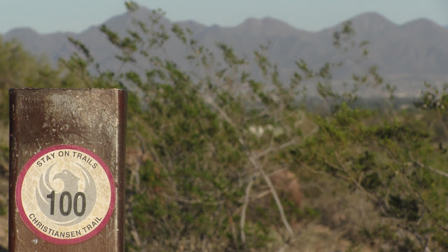
Trail 100, Phoenix Mountains Preserve
Charles M. Christiansen (100) on Trailforks.com
Trail #100 is a classic Phoenix ride. It covers almost 11 miles from East to West and is chuck full of additional trails to suit your riding ability. I used to live very close to the Tatum Trailhead and enjoyed riding trail 100 often.
Many reviews of trail 100 say that it’s pretty easy and relatively flat. True, for some sections. But while trail 100 is the most famous trail in the area, it’s hardly the most or least difficult.
Get to know the area and study the maps…then go explore. If you want to start from the East side, be warned that the Tatum trailhead has only a few parking spots – literally – and there is nowhere else to park nearby. If they are full, you have to drive to the 40th street lot.
From the West side you can start at the Mountain View Park trailhead on 7th Avenue or the 7th Street trailhead. As most reviews tell you, the best riding is east of the Dreamy Draw. West of the Dreamy Draw has some nice singletrack, but there is quite a bit of wide flat double track too.
The Dale Wiggins Topo of the Phoenix Mountain Preserves is the best topo of the entire trail system: Includes trails 1A, 220, 3, 3A, 3B, 300, 302, 304, 200, 200A, 100A, 306, 60, 44 and even more unnamed trails.

Read about Trexnfx and his recent visit to Phoenix where he rode trail 100 on a Pivot Mach 429. T100 Part I | T 100 Part II See all his sweet photos here.
North Mountain Area
Piestewa Peak (formerly Squaw Peak)/ Dreamy Draw
Excellent review of a more advanced route of 100 by Continental on MTBR.com
I used to ride trail 100 back in the 80’s and early 90’s back then it was a Horseback Trail which sort of sucked to ride on because the trail was mostly loose pack. But the great part was, every saddle, there would be a difficult trail to climb up and over on my bike making it better. I clocked a lot of miles back then riding bikes with no suspension. 2 different beach cruisers converted to 10 speeds. And my first mountain bike in 1990 and second in 1992. Back then it was great because there were not a lot of trail traffic to deal with.
Trail 100 if you start at Mountain View Park at 7th Ave. has parking, water and restrooms. At North Mountain Vistor Center on 7th St. has parking, water and restrooms. Dreamy Draw Park has parking, water and restrooms. End of 40th St. has parking, water and restrooms. Tatum Blvd. has limited parking, no water, no restrooms. About 11 miles end to end.
Pingback: Arizona Bucket List – Things to do in Arizona | Louisa Ward, Robyn Viktor, Chuck Ward | Real Estate Agent | Phoenix AZ Homes For Sale
Pingback: ARIZONA BUCKET LIST – 12 REASONS TO VISIT ARIZONA – MUSST VIEW
Pingback: Arizona Bucket List - 12 Reasons to Visit Arizona -
We are planning on hiking the entire trail 100 in March. Can someone please tell me exactly where the trail begins/ where to park on the east side? We want to hike east to west so the sun is not in our face. Thanks! Also – we wanted to leave a car with food and extra water somewhere in the middle. I think the trail crosses Cave Creek Road, 7th St and 7th Ave. Any recommendations on where I can park a car for the day that is at the trail? I appreciate any advice.
Maria, as there are several miles of trail and connecting loops, you can hike as short or long as you’d like. Only water station (drinking fountain) would be at the Dreamy Draw Trail Head side.
How long does it take to walk trail 100? Ae there water stations along the way? Maria
Park at Tatum. Small parking area but hardly used. No fees. Great place to start. I like getting dropped off at 7th st and riding to Tatum (live near there). It’s a good ride with a little bit of everything.
I hike this trail almost daily and enter it near 18th Street and Northern. You can enter the trail from many places, meaning there is no means for it to be monitored regarding permits or fees. Same for the bikers I share the trail with. Just get on it and go! Lots of different scenery and, for a biker, nice and long (about 11 miles). Pretty flat. There is a water station at Dreamy Draw Park. None other mid-course though. There is an equestrian tunnel under Rt 51 near Dreamy Draw Park, so east and west of that are on opposite sides of that highway. So cosider that when plotting your course and deciding where to park your vehicle.
I ride TR 100 all the time – don’t know what the previous reviewer is talking about – no permit needed. Maybe confused this with the McDowell loops where you do have to pay to park. Last time we were there it was $8/car so bring singles. Worth it (there are even showers at the trailhead!)
Pingback: 5 Awesome Places to Mountain Bike in Phoenix, Ariz. « No Crocs Allowed